The HIGHROC project
Project summary
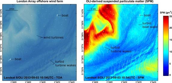
The HIGHROC (HIGH spatial and temporal Resolution Ocean Colour) project will carry out the research and development necessary for the next generation coastal water products and services from ocean colour space-borne data by giving an order of magnitude improvement in both temporal and spatial resolution. These improvements will both open up new application areas for remote sensing, such as the assessment/monitoring of environmental impacts from dredging and offshore construction, and will strengthening existing applications, such as the assessment and monitoring of water quality in the context of the European Union Water Framework and Marine Strategy Framework Directives.
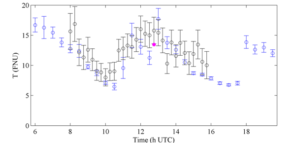
High temporal resolution (SEVIRI: 15 mins)

High spatial resolution (Sentinel-2: 10m)

HIGHROC project duration:
Jan 2014 – Dec 2017
HIGHROC consortium:
RBINS (coordinator), UMPC, NIVA, BC, VITO, CEFAS
HIGHROC brochures:
HIGHROC Final Report: (PDF, 1.7MB)
Latest HIGHROC news
20 Oct 2017
HIGHROC Science Conference
15 Oct 2017
HIGHROC User Workshop #2 in Hamburg
31 Aug 2017
iCOR atmospheric correction released
