
HIGHROC Products
High spatial resolution : S2/MSI
General information:
- sensor: Sentinel-2 / MSI (MultiSpectral Instrument)
- spatial resolution: 10m
- temporal resolution: 10 days at the equator
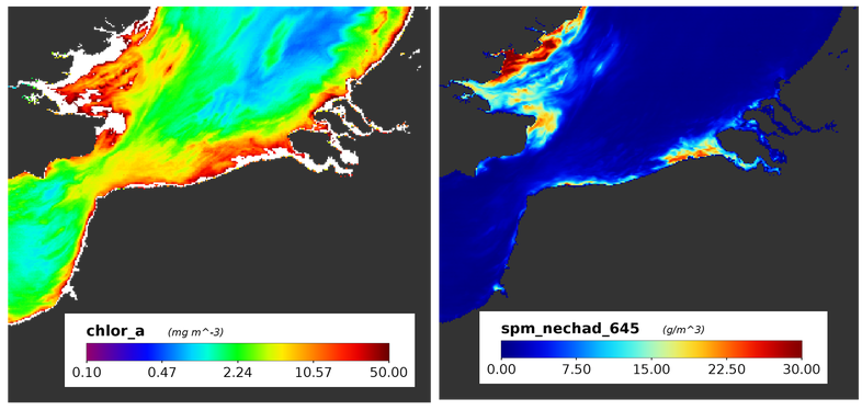
- parameters: Rrs, SPM, Turbidity, Chlorophyll-a, RGB images
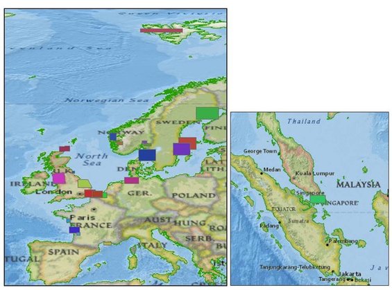
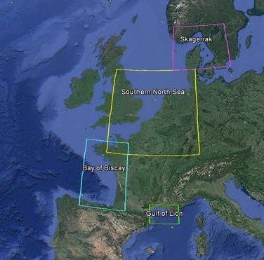
- regions processed: see map below
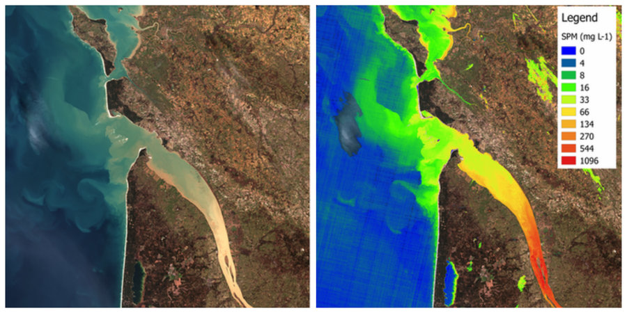
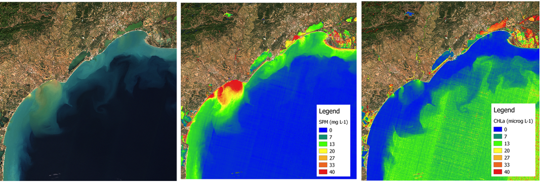
Examples of products
Product Validation
First results on product validation show an uncertainty of about 30% on water leaving reflectance. Validation of SPM, chlorphyll-a and turbidity products is still ongoing.
High spatial resolution : L8/OLI
General information:
- sensor: Landsat8 / OLI (Operational Land Imager)
- spatial resolution: 30m
- temporal resolution: 16 days at the equator
- parameters: Rrs, SPM, Turbidity, RGB images
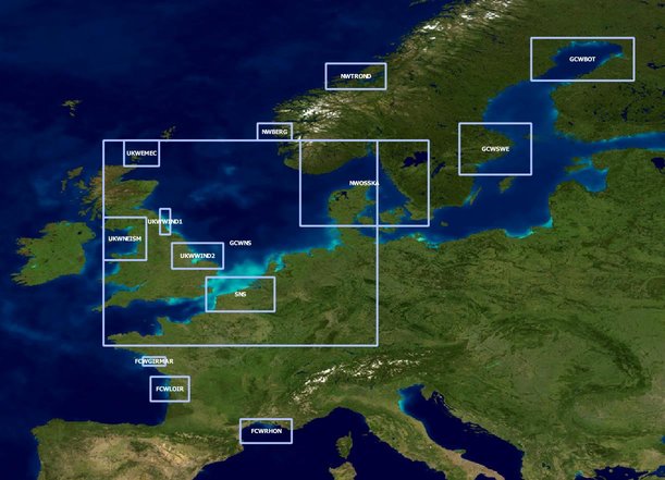
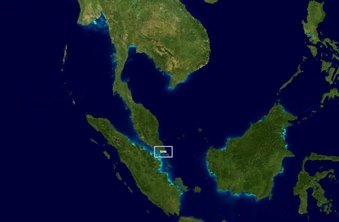
- regions processed: see map below
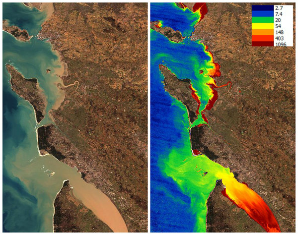
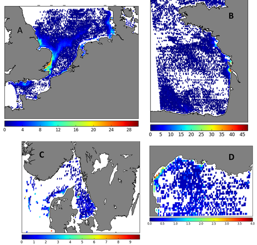
Examples of products
Product Validation
First results on product validation show a uncertainty of about 17% on water leaving reflectance with a good correlation between in situ and satellite measurements (r2=0.95). Regarding SPM, validation exercises in the Rhone River, Gironde Estuary and Bourgneuf Bay give 38%, 35% and 31% error respectively. Validation of the L8/OLI products in the Norwegian region is still ongoing.

Moderate spatial and temporal resolution : MODISaqua and VIIRS
General information:
- sensor: MODISaqua (Moderate Resolution Spectroradiometer) and VIIRS (Visible Infrared Imaging Radiometer Suite)
- spatial resolution: 500m (MODIS), 750m (VIIRS)
- temporal resolution: 1 to 2 days
- parameters: Rrs, SPM, Turbidity, Chlorophyll-a, RGB images
- regions processed: see map below
Examples of products
Product Validation
Uncertainty on remote sensing reflectance varies with bands and regions. Lowest uncertainties are generally obtained for the blue bands (443nm) with values ranging between 43% in the Gironde Estuary to 15% in the Rhone River plume, in the Southern North Sea uncertainty is estimated to 29%. Lowest uncertainties are observed for the green band (555nm) and range between 6% (Rhone River plume) and 18% (Southern North Sea). Suspended particulate matter products have varying uncertainties: 9% in the Southern North Sea, 18% in the Rhone River Plume. Chlorophyll concentration and turbidity products could only be validated in the North Sea and Norwegian waters. In the North Sea, an uncertainty of 28% is observed for chlorophyll-a. In Norwegian waters, chlorophyll-a is generally overestimated by satellite products especially in regions of low salinity. Regarding turbidity, an overestimation is observed in both regions although seasonal variability is well reproduced.

High temporal resolution : MSG/SEVIRI
General information:
- sensor: Spinning Enhanced Visible and Infrared Imager (SEVIRI) onboard Meteosat Second Generation
- spatial resolution: 3km at equator
- temporal resolution: 15 minutes
- parameters: Rrs, SPM, Turbidity
- regions processed: see map below
Examples of products
Product Validation
Please note that validation is still ongoing. Present results will be confirmed and completed in the future.
SPM products have been validated in the North Sea region. Results show a slight underestimation of SPM by SEVIRI products and a coefficient of correction of 0.56.